
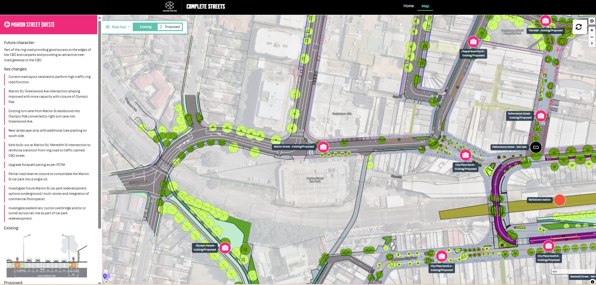
The map needed to provide a detailed, interactive interface where users can select individual streets and see existing vs proposed character, key design changes (such as widened footpaths, bike lanes, traffic calming and new public spaces) and future amenity outcomes. It supports the broader Complete Streets masterplan by illustrating how integrated transport planning and placemaking interventions will improve accessibility, safety and urban character throughout the CBD over time
The interactive map offers stakeholders a clear, engaging way to visualise complex design proposals at the street level, making abstract planning concepts tangible and easier to interpret. It supports informed community engagement by enabling residents, businesses and decision‑makers to explore specific local changes — from separated bike lanes to shared zones and tree‑lined streets — in context, rather than relying on static PDFs or text descriptions. By layering proposed future conditions alongside existing street configurations, the interface highlights design intent and anticipated benefits such as slower traffic speeds, enhanced pedestrian amenity and stronger links between transport nodes and public spaces. The tool also facilitates transparency and trust, as all users can access the same authoritative information without barriers. For the project team, the map functions as a communication and consultation asset that can focus discussions, collect feedback and reduce repetitive queries about specific locations. Overall, this interactive page strengthens understanding of the Complete Streets vision, supports collaborative planning, and helps build consensus around long‑term improvements to Bankstown’s urban environment.

